Description
THE WORLD IS TO BE EXPLORED. FIND THE BEST WAY TO DO IT.
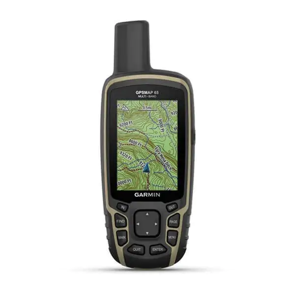
Expand your boundaries with the new handheld GPS and the best tracking accuracy, 2.6-inch colour screen and pre-loaded maps.
Don’t miss a single detail thanks to the large, anti-glare colour screen.
Explore the most remote areas with innovative multi-band technology and expanded GNSS satellite support.
It traverses open spaces with the support of TopoActive Europe maps.
Venture out with confidence. It is the portable navigator designed for the harshest environments.
Plan your outing anywhere with the Garmin Explore™ website and app1 .
Travel with the confidence of up to 16 hours of battery life in GPS mode.
EXTENDED GNSS SUPPORT
Support for multi-band technology and GNSS (GPS, GLONASS, Galileo, QZSS and IRNSS) provides optimal accuracy in areas with poor reception, in cities or in open spaces with obstacles.
TOPOACTIVE EUROPE PRELOADED MAPS
TopoActive Europe maps provide detailed views of the road and trail network, waterways, natural features, land use areas, buildings and more.
SMART NOTIFICATION
Receive e-mails, text messages and alerts directly on your mobile device when paired with a compatible smartphone.
MICROSD™ SLOT
With your compatible device and a microSD memory card, conveniently download even more detailed maps such as TrekMap Italia V6, the topographic map of our country at a scale of up to 1:5,000, an extensive trail network and ActiveRouting functions to be guided according to your activity or means of movement.
GEOCACHING
Get automatic cache updates from Geocaching Live, including descriptions, logs and tips.
GARMIN EXPLORE APP
Plan, review and synchronise waypoints, routes and tracks using the Garmin Explore1 app and website. You can also review completed activities while you’re still out and about.
 ITA
ITA
 DEU
DEU
 FRA
FRA
 ESP
ESP


